
Super Typhoon Threat Looms as Tropical Depression Nando Intensifies
As Tropical Depression Mirasol exits PAR, the Philippines braces for potentially severe weather as Tropical Depression Nando shows signs of developing into a super typhoon, threatening Northern Luzon.
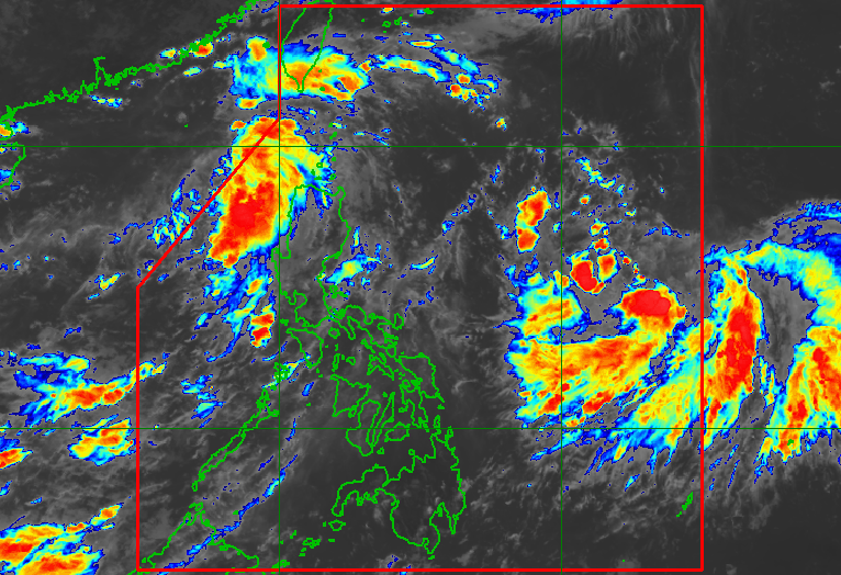
Satellite imagery showing Tropical Depression Nando's development as it approaches the Philippine Area of Responsibility
Weather System Update: Mirasol Exits, Nando Strengthens
The Philippines faces a potentially severe weather challenge as Tropical Depression Mirasol exits the Philippine Area of Responsibility (PAR) while Tropical Depression Nando shows concerning signs of intensification.
PAGASA reported that Mirasol left PAR at 6 am Thursday, September 18, positioned 395 kilometers west of Calayan, Cagayan. The system accelerated westward toward China at 35 kilometers per hour, maintaining winds of 55 km/h and gustiness up to 70 km/h.
Nando's Alarming Development
Of greater concern is Tropical Depression Nando, which could potentially evolve into a super typhoon as it approaches extreme Northern Luzon. This development comes amid increasing regional tensions and weather-related challenges in the Philippine maritime zone.
Preparation and Safety Measures
- Signal No. 1 may be raised in Northern Luzon by Saturday
- Heavy rainfall expected from Sunday to Monday
- Maritime activities restricted with waves up to 2 meters high
- Small vessels advised to take precautionary measures
The weather bureau's enhanced monitoring systems, part of the country's modernized infrastructure investments, are tracking Nando's development as it maintains its slow northwest movement over the Philippine Sea.
Impact on Maritime Activities
Moderate to rough seas are expected along the eastern seaboard of mainland Cagayan, seaboards of Batanes, Babuyan Islands, and the Ilocos region. The southwest monsoon continues to affect Mimaropa and Western Visayas with scattered rain and thunderstorms.
Statistical Context
Mirasol and Nando mark the Philippines' 13th and 14th tropical cyclones for 2025, reaching the upper limit of PAGASA's projected range for September weather disturbances.
Manny Pacquiao
Independent Filipino journalist covering democracy, civil rights, and government accountability across Southeast Asia.