
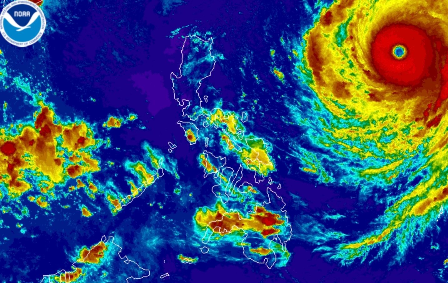
Super Typhoon Rosal strengthened slightly over the Philippine Sea on Tuesday afternoon, October 20, hours after entering the Philippine Area of Responsibility, with state forecasters warning that its outer bands and gale-force gusts will reach far beyond the areas under wind signals.
The Philippine Atmospheric, Geophysical and Astronomical Services Administration (PAGASA) said in its 5 pm bulletin that Rosal's maximum sustained winds rose to 195 kilometers per hour, up from 185 km/h earlier in the day, while its gustiness increased from 230 to 240 km/h. It is the country's 18th tropical cyclone of 2026 and the first for October.
Where is Rosal now and where is it headed?
As of 4 pm Tuesday, Rosal was located 1,270 kilometers east of Central Luzon, moving west northwest at 25 km/h. It entered PAR at 10:40 am, according to Rappler and confirmed by state broadcaster PTV News.
The storm will not make landfall in the Philippines, PAGASA said, but its size and intensity mean it will still affect large parts of the country. It will be closest to extreme Northern Luzon from Thursday, October 22, to Friday, October 23.
PAGASA expects Rosal to keep its west northwest track until Wednesday, then turn generally northwest until Friday morning. It may then shift north northwest to north starting Friday afternoon and leave PAR by Friday evening or early Saturday morning, October 24. Further intensification is possible over the Philippine Sea, though the storm could weaken into a typhoon by Thursday evening or early Friday morning. ASTIG reports the system may further weaken into a severe tropical storm by Saturday evening or Sunday morning.
Which areas are under Signal No. 1?
More areas were placed under Tropical Cyclone Wind Signal No. 1 as of 5 pm Tuesday, meaning residents should prepare for strong winds. The signal covers Batanes, the Babuyan Islands, the northern part of Ilocos Norte including Pagudpud, and wide swaths of mainland Cagayan including Aparri, Santa Ana, Gonzaga, Claveria, Sanchez-Mira and Pamplona.
It also covers the northeastern part of Isabela, specifically Maconacon, Divilacan and Palanan, and the northeastern portion of Catanduanes including Pandan, Viga and Gigmoto. PAGASA said the highest wind signal Rosal could raise is Signal No. 2 or 3.
Philstar.com reported that Signal No. 1 remains in effect over parts of Luzon as the storm continues its approach.
Rainfall forecast for Northern Luzon
Rosal's trough, or extension, may bring scattered rain and thunderstorms to more areas Tuesday evening, with the forecast now covering the entire regions of Bicol and Eastern Visayas.
For the 24-hour period from Thursday afternoon to Friday afternoon, PAGASA expects heavy to intense rain of 100 to 200 millimeters over Batanes, and moderate to heavy rain of 50 to 100 mm over Cagayan. For now, Batanes, Ilocos Norte and the Babuyan Islands will only see isolated light rain from the northeasterly windflow.
Gale-force gusts and dangerous seas
The northeasterly windflow and Rosal's outer bands will bring strong to gale-force gusts across a long list of areas. On Tuesday, that includes Batanes, Ilocos Norte, Cagayan, Isabela, the Polillo Islands, Camarines Norte, Camarines Sur, Catanduanes, Northern Samar, Eastern Samar, most of Caraga, Camiguin, Misamis Oriental, Sarangani, Davao del Sur and Davao Occidental.
On Wednesday the gusts expand to the Ilocos Region, the Cordillera Administrative Region, Cagayan Valley, Bicol, Romblon, Eastern Visayas, Iloilo, Guimaras, Negros Occidental, Siquijor, Bohol, Northern Mindanao, Caraga, the Davao Region, Sarangani and Zamboanga del Norte. By Thursday, PAGASA warned, gusts could hit most of the country.
Fishermen and coastal communities face the sharpest danger. PAGASA's 24-hour sea advisory places the northern and eastern seaboards of Catanduanes, the seaboard of Isabela, the northeastern seaboard of mainland Cagayan, the southeastern seaboard of Batanes and the northeastern seaboard of the Babuyan Islands under very rough seas, with waves up to 4.5 meters. Travel is risky for all vessels there.
Waves of up to 4 meters will make conditions rough along the eastern seaboard of Albay and Sorsogon, the eastern seaboards of Northern Samar and Eastern Samar, and the northern seaboards of Camarines Norte and Camarines Sur, among others. Small vessels should not venture out to sea in those waters.
Moderate to rough seas, with waves up to 2.5 meters, were forecast for the seaboards of Surigao del Sur, Surigao del Norte, Davao Occidental and the eastern seaboard of Davao Oriental. PAGASA advised small vessels in those areas to take precautions or avoid sailing altogether.
Amihan season and El Niño in the background
The storm arrives as the Philippines transitions into the northeast monsoon, or amihan, after the southwest monsoon, or habagat, ended on October 5. The amihan usually brings surges of cold temperatures, but the coming months could be warmer than usual because the strong El Niño now sitting over the tropical Pacific is predicted to become very strong in the fourth quarter of 2026.
For farmers in the rice and corn belts of Cagayan Valley, and for fishing communities from Batanes to Catanduanes, the message from PAGASA is plain: no landfall does not mean no danger. The next three days will test whether local governments and coastal residents take the sea warnings seriously.
FAQ
Will Super Typhoon Rosal make landfall in the Philippines?
No. PAGASA said Rosal is not expected to make landfall, but its size and intensity mean it will still bring rain, gusts and rough seas to parts of the country.
When will Rosal be closest to the Philippines?
PAGASA said Rosal will be closest to extreme Northern Luzon from Thursday, October 22, to Friday, October 23.
What is the highest wind signal possible from Rosal?
PAGASA said the highest tropical cyclone wind signal Rosal could raise is Signal No. 2 or 3.